After reaching the top of Win Hill on my first day in the Peak District, I had to decide which way to go back down: either take a steep direct climb into the valley, or follow a road across the hilltops. I had decided on the direct route down, but on my third day I figured it was time to go back and see where that road would take me.
The hike started on now familiar terrain, across bucolic pastures:

Looking back as I climbed, I could see Castleton and Cave Vale in the distance. Hiking in the hills means you can often catch a view of where you'd been the day before.

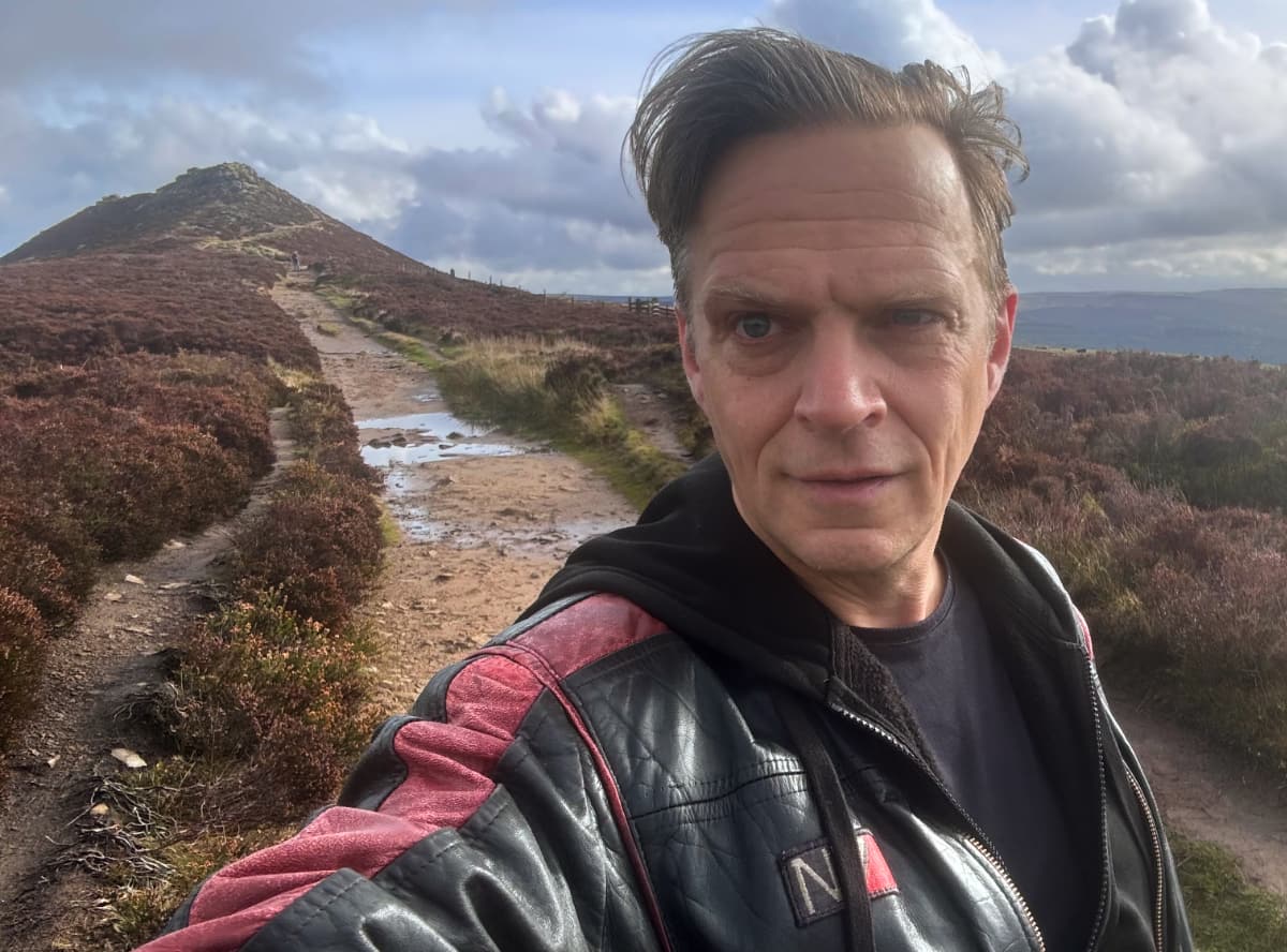
Back on the "pimple" of Win Hill, I could see the road not taken stretching across the heather toward a patch of forest in the distance:

Taking in the view from the top one last time, I made my way down to the road and started my day's trek.
I gather that this is the path of the old Roman road. In the days of travelling on foot, it was easier to have roads go along hilltops and ridges, since after the initial climb there's less topography to deal with and hilltops are more clear of vegetation and settlement than the valleys, so you can make better time.
This road certainly had that trademark Roman straightness, and I wondered if any of the stones I was walking over had been part of the original Roman works. It seems very unlikely after 1700 years of British weather and foot (and hoof) traffic, but sometimes it still looked paved and fitted. It was fun to imagine legions marching along this same route, although it was likely much more often carts loaded down with lead from the local mines.

The road turned a corner along the ridge-line and I had a good view of Lose hill across the way. Local legend has it that Win Hill and Lose Hill got their names from a 7th century battle in the valley between the two peaks, with the army from Win Hill prevailing. It turns out, though, that the names were Old English for "willows" (wythine) and "pigsties" (hlose). Win Hill won at least the naming competition.

The land up among the heather was occasionally crossed by old stone fences and gateposts. There are neolithic standing stones and circles in the Peak District, but they were all too far away from Hope to visit on foot – so I contented myself by pretending these probably 18th-century gateposts were placed by druids.

Further along the heather gave way to pasture and grassland. To the right was a stone fence and a treeline. To the left was ... an open world.

The sense that one could just freely walk anywhere was intoxicating. The rolling landscape stretched out ahead of me. There were a few other hikers around, and the occasional mountain-biker, but the predominant feeling was of liberty and glorious isolation. I could have, in theory, walked to anything I could see. And I was on nobody's schedule or agenda other than my own. This was a welcome relief from the stresses of the last few weeks.
Wikipedia notes that the Peak District is only about an hour by car or train from 20 million people. You wouldn't know it from the view.

It isn't a coincidence at all that this countryside looks like the Shire from the Lord of the Rings. Much of the first book is concerned with wandering the hills and dales of cozy Midlands countryside, with some scary elements mixed in. Thankfully there were no Ringwraiths or haunted barrow-downs here, only sheep and some abandoned stone barns.
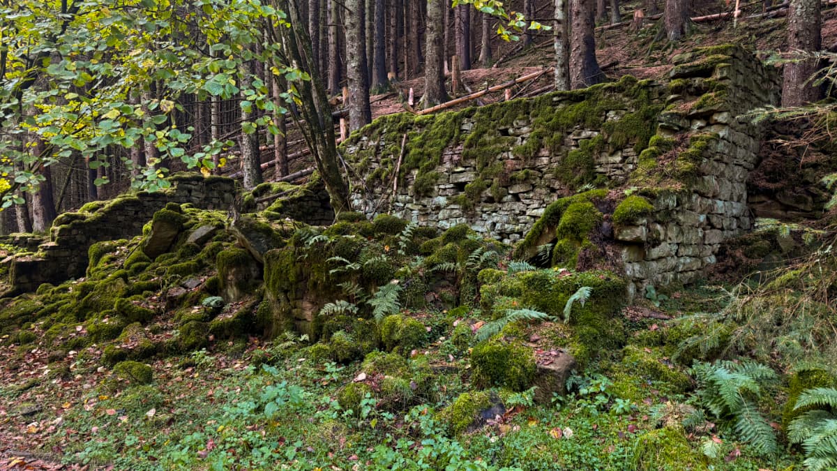
Eventually I reached a crossroads where a gap in the fence led into the forest. It was time to head downhill towards the reservoir. Clearly these trees were re-planted at some point, as they're all the same type and age and evenly spaced.

Just because it was a man-made forest didn't make it feel any less fantastical. Closer to the valley floor I came across the ruins of some kind of old stone building, all overgrown with moss and even some sizeable trees.
I noted earlier that there were no haunted barrow-downs on this hike – but this certainly felt like it might be home to old spirits. Did this gateway lead to another world?

The moss-rounded posts just beyond had me wondering if I had in fact entered a Miyazaki movie.

I soon emerged from the forest by the reservoir. The opposite slopes, filled with autumn colours, made me feel like I was back in Canada again.

I followed the well-paved road along the reservoir and eventually made it to the dam that created it. This dam had a unique feature: two giant "plugholes" which act as drains if the water level gets too high. This certainly wasn't a concern after the extremely dry summer the UK had had in 2025.
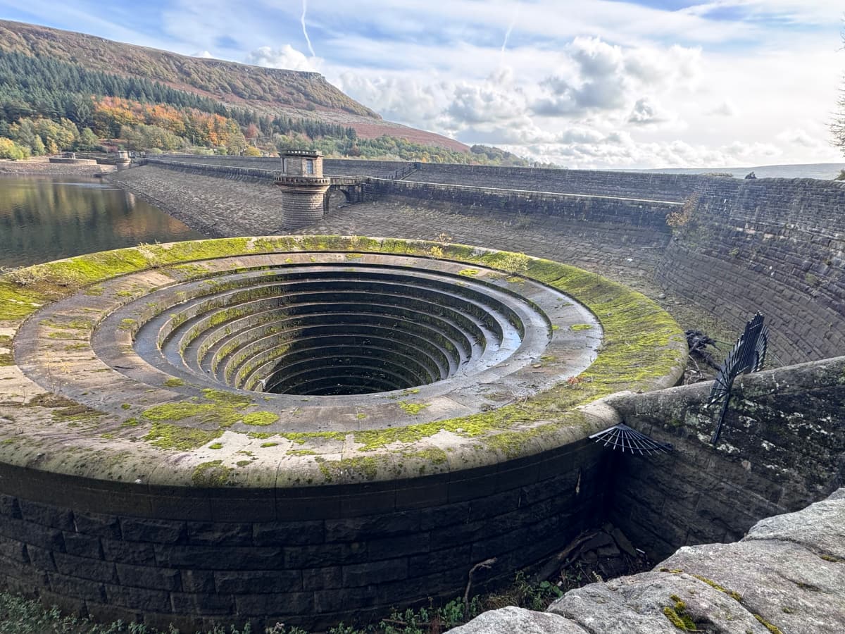
Seeing these massive mossy stoneworks, I realized what today's hike had reminded me of: the lonely land of Shadow of the Colossus. The moody forests, the rocky canyons, the grassy hillsides, the enigmatic architecture. No loyal horse or scary giants though.
I continued into the valley beyond the dam, and came across the base of the steep rocky staircase I had found so challenging on my first day of hiking. I had come full circle!

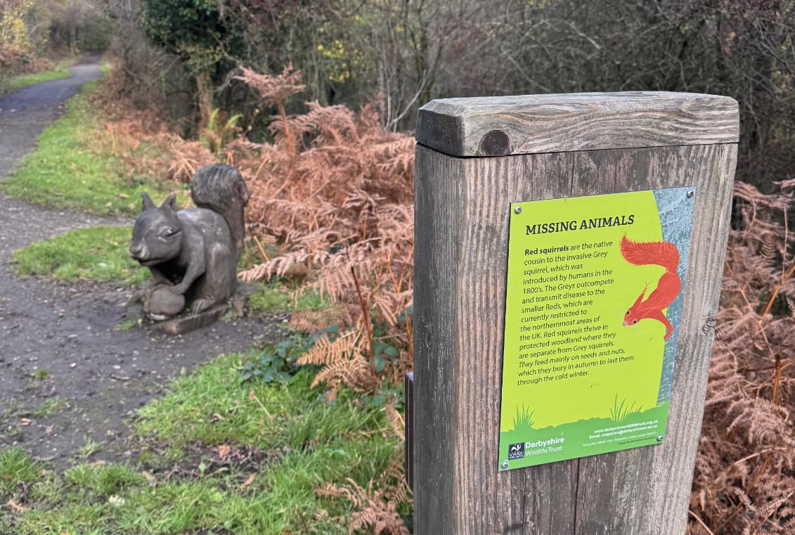
I took a different route around the base of the hill, along an interpretive trail that highlighted all the animals that used to live in this area but no longer do, represented by statues and explanatory signs.
I finally ended up walking along the main road towards Hope. I came across another "honesty box" – this one featuring fresh local eggs.

With the traffic and the farms, the final stretch back to Hope wasn't as marvellous as the hilltops I had been on earlier. However I passed some extremely charming houses. How can "Melody's Corner" be so lovely?

Finally I made it back to the hotel. Today's hike was the longest of them all: nearly 19km in over 4 hours of walking!


I had a well-deserved beer and curry for lunch and rested up. Tomorrow I would catch a train to Birmingham and return to urban bustle.