I had had such a great time yesterday in the Peak District that I was looking forward to what I would find on today's hike. The weather was looking like it might be damp, so I decided to head to the next town over, Castleton, which I gather had caves and a castle I could explore if it was too rainy for wandering.
The day turned out to be mostly sunny, but occasional rainclouds would come by, dropping some light misty showers for a few minutes and then moving on. This was actually rather pleasant, but my entire day was punctuated by these kinds of alerts popping up on my phone and watch:

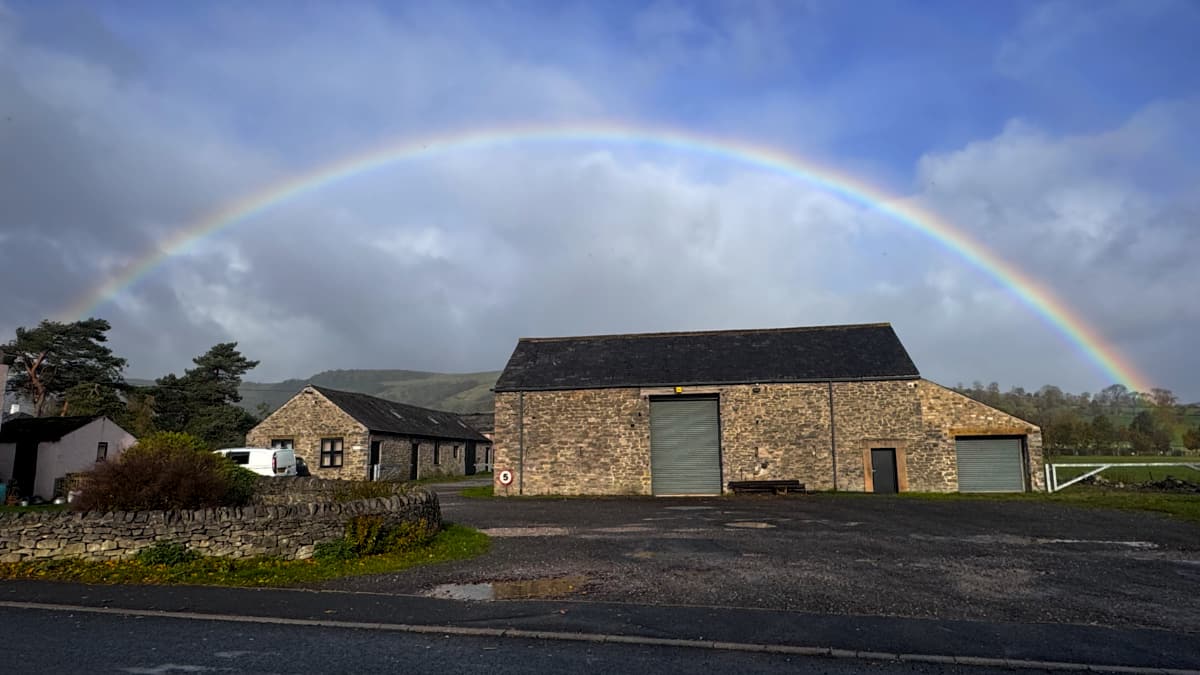
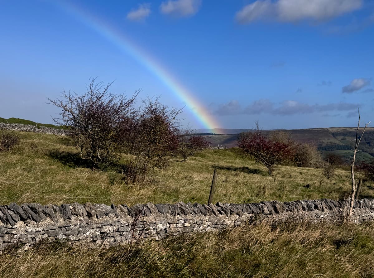
On the plus side, these little bursts of rain on an otherwise sunny day made for lots of rainbows. Even parking lots and random garages became wondrous:
Castleton was only about 20 minutes of easy walking down the main road. I stopped by the Peak District Visitor Centre and finally picked up a small pocket guide so I could actually look things up instead of just guessing. Even with the guide, though, I decided to just wander around and see what I could find.
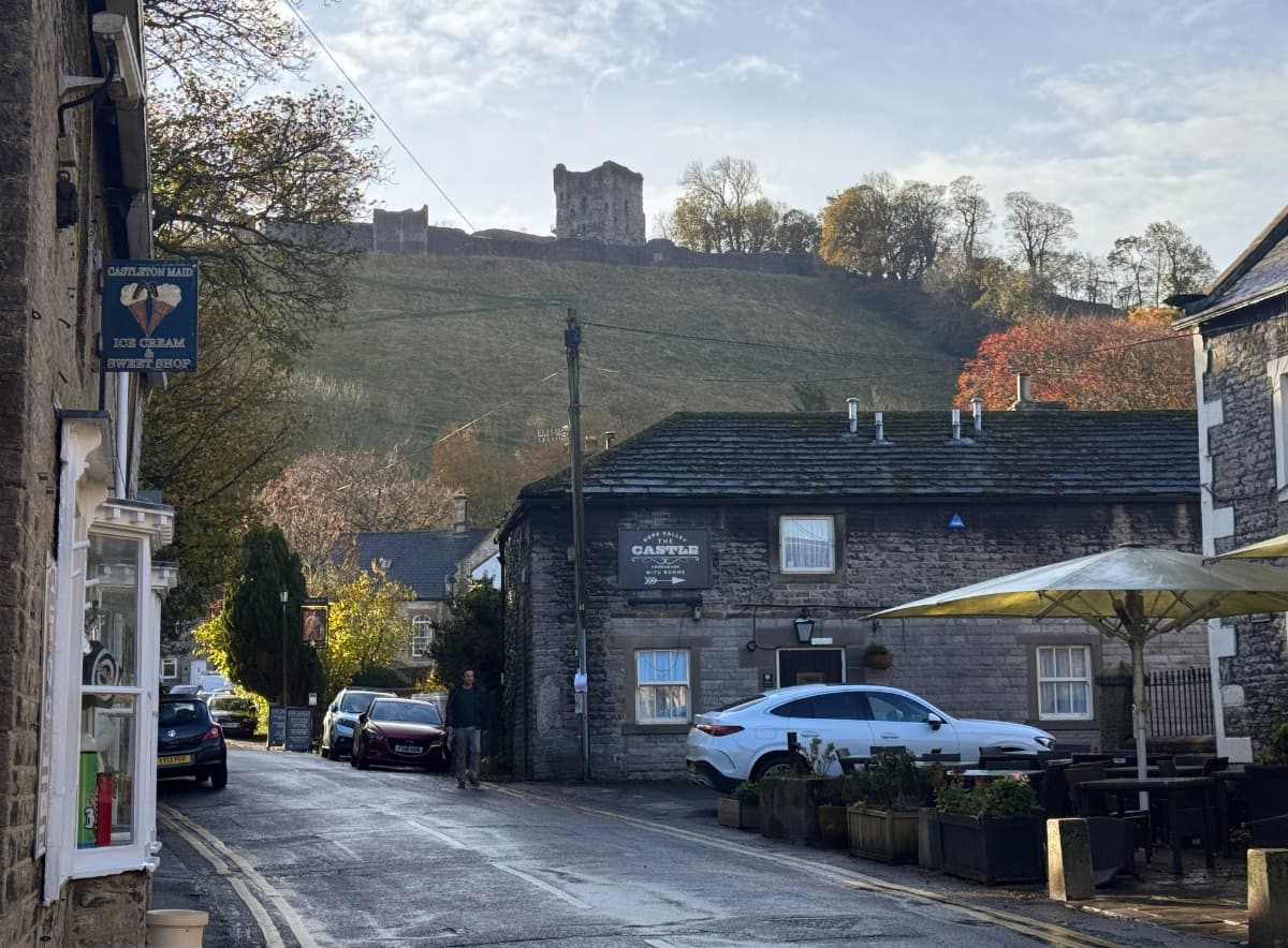
Castleton lives up to its name, with a Norman castle watching over its pubs and inns from above:
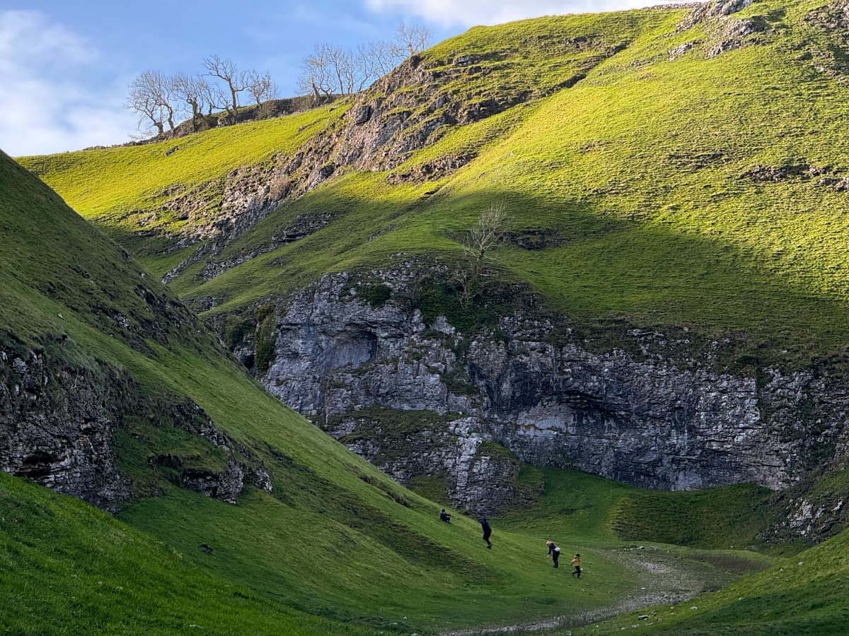
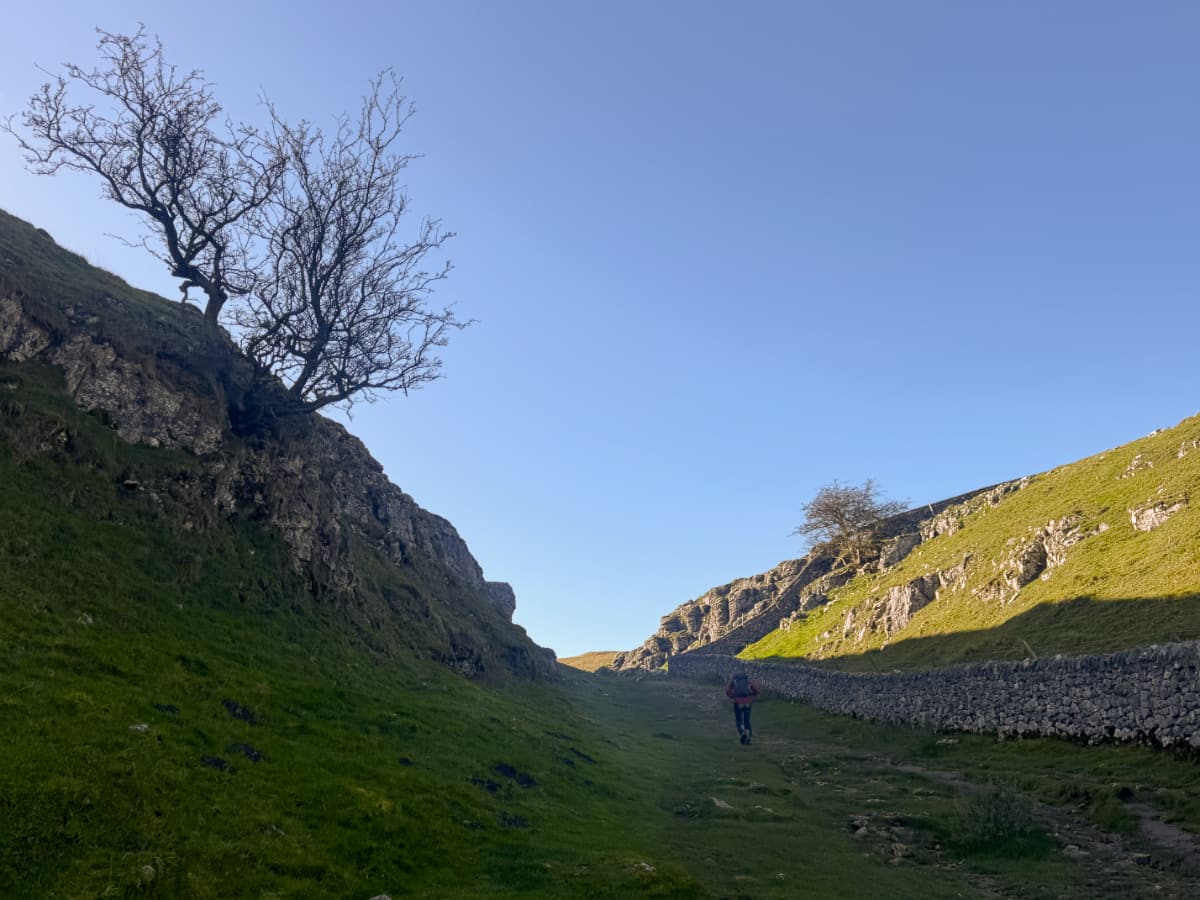
While wandering the streets I found a little side alley with an old sign pointing to the intriguingly named "Cave Vale" – I just had to check it out. The entrance was a narrow pass between two cliffs, but soon opened up with some atmospheric trees and something evocative in the distance:
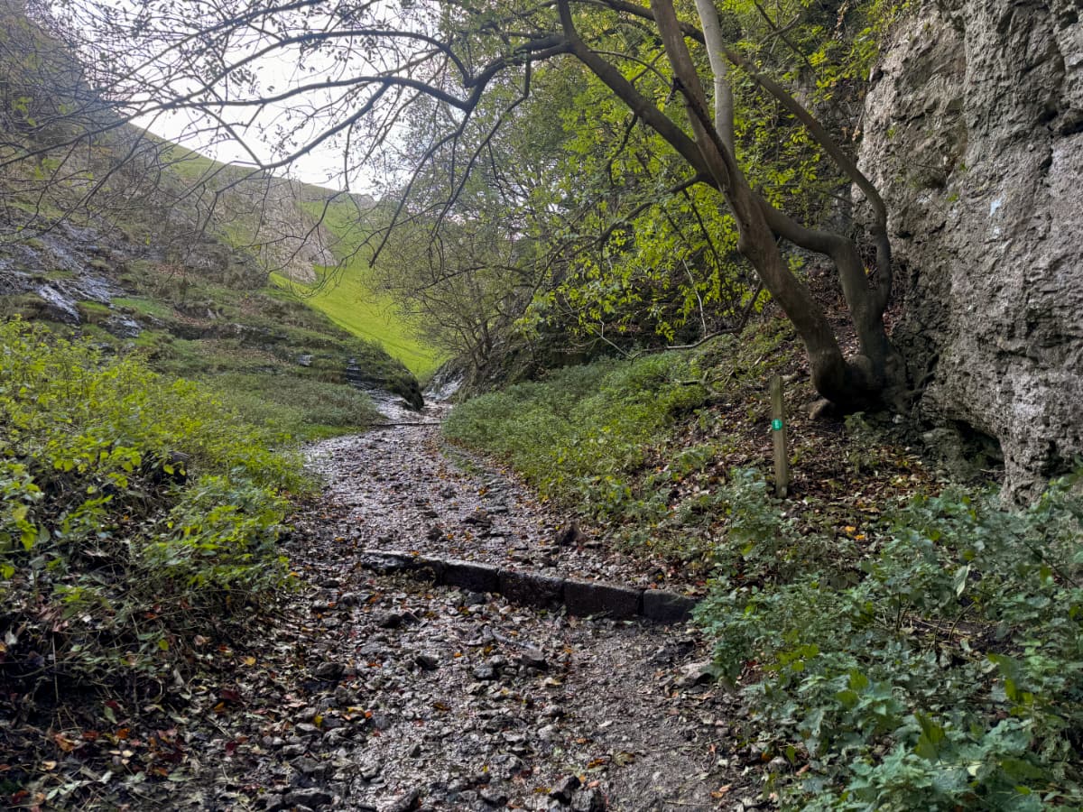
A bit further on I discovered that I had stepped into a fantasyland:
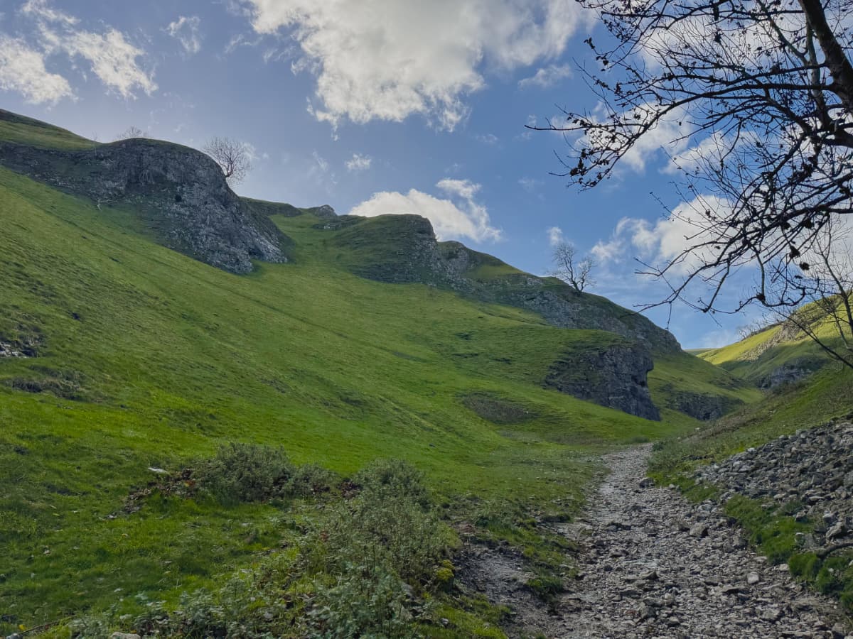
This felt very much like a landscape from a classic fantasy game like Dragon Age or Elder Scrolls or something like that. The varied texture maps on the steep terrain mesh were impressively rendered. I half expected to be ambushed by goblins rushing from the cliffs and the caves.
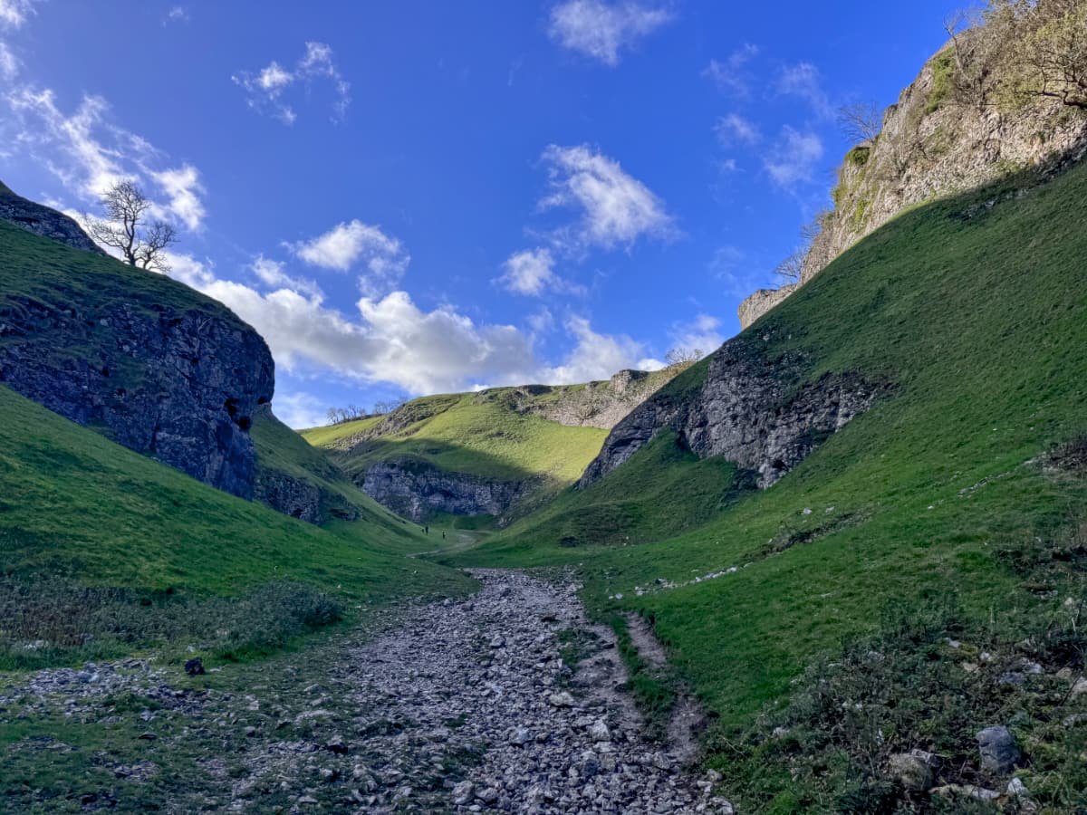
The low, bright sunlight challenged my iPhone's camera, but it also made everything look even more magical. There was even a castle, shining above.
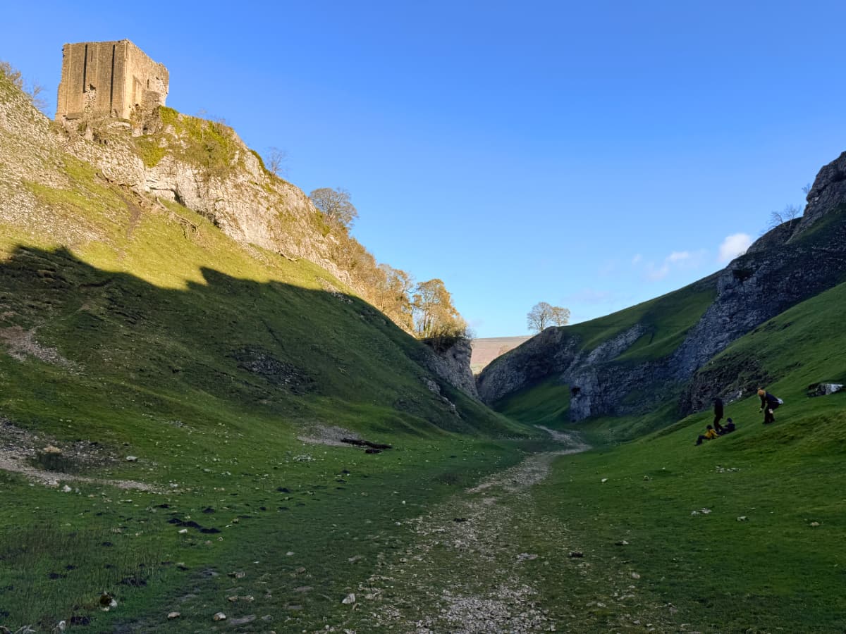
I racked my brain trying to figure out why this place seemed so familiar. It looked a little bit like the rocky New Zealand plains Peter Jackson used to stand in for the steppes of Rohan in the Lord of the Rings movies, but that wasn't it. I also thought it might have been the canyon where Brienne of Tarth fights The Hound in Game of Thrones but that's darker and rockier and presumably somewhere in Iceland.
Finally, as I'm writing this, several months after returning home, I have figured out why this seemed so familiar: it's the "As You Wiiiiiiiish!" hillside from "The Princess Bride"!
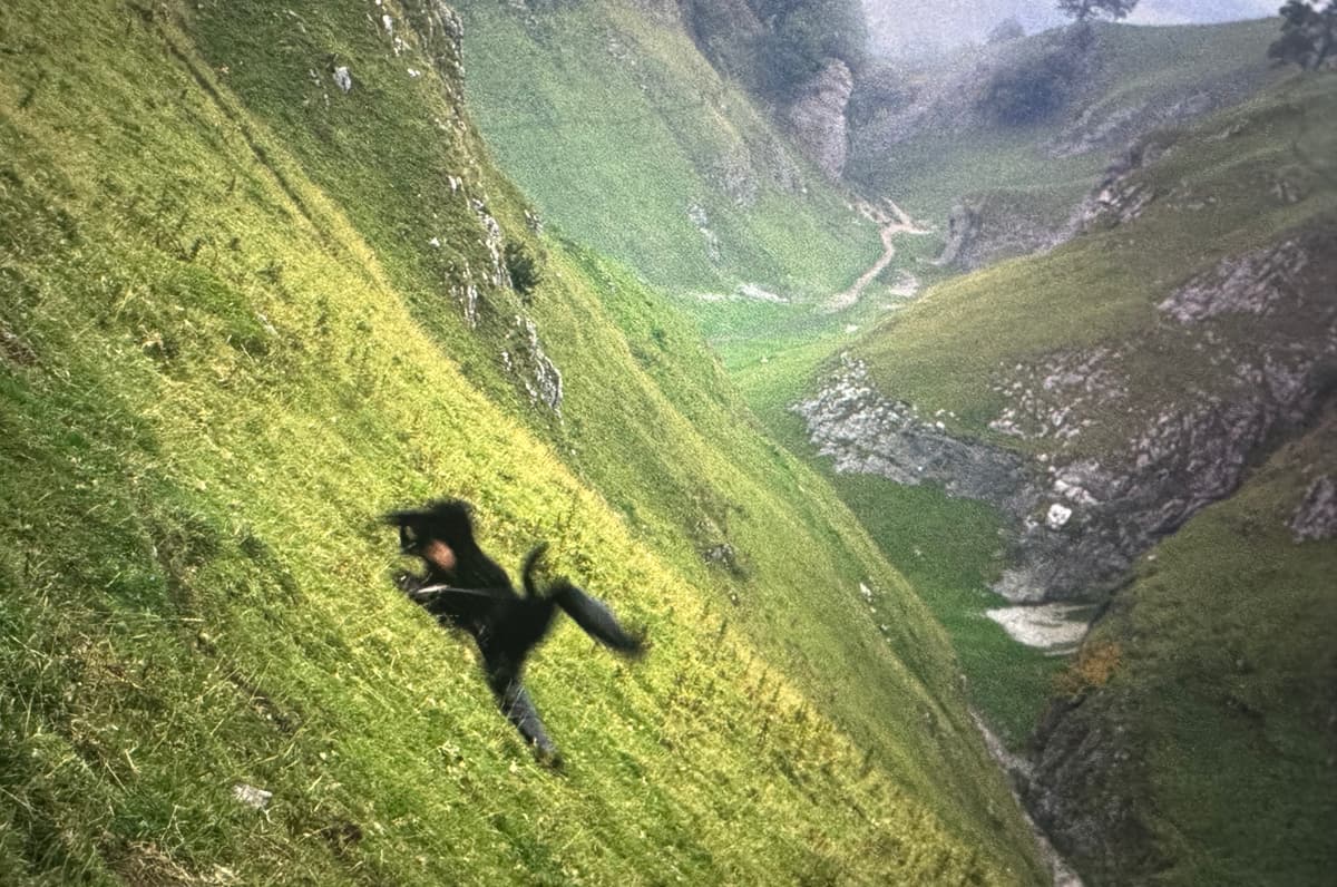
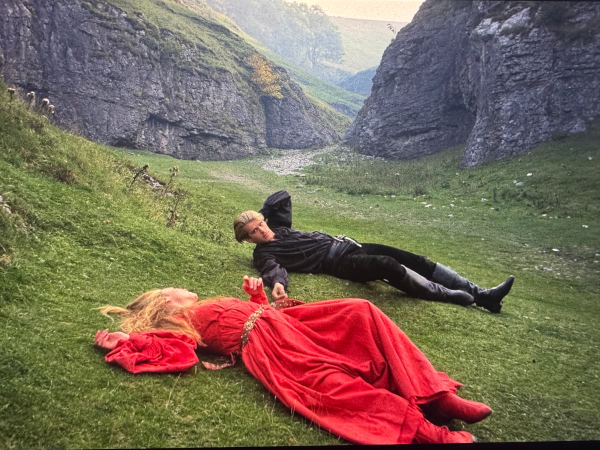
See the similarities? I had a sunnier day, but the light levels were harder to work with.
I couldn't find an exact match from the photos I had taken. Presumably it's changed over the last 40 years.
The way up the vale was a half pathway, half streambed, and entirely steep and rocky.
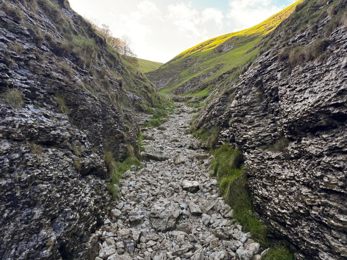
The views looking back were well worth the effort though:
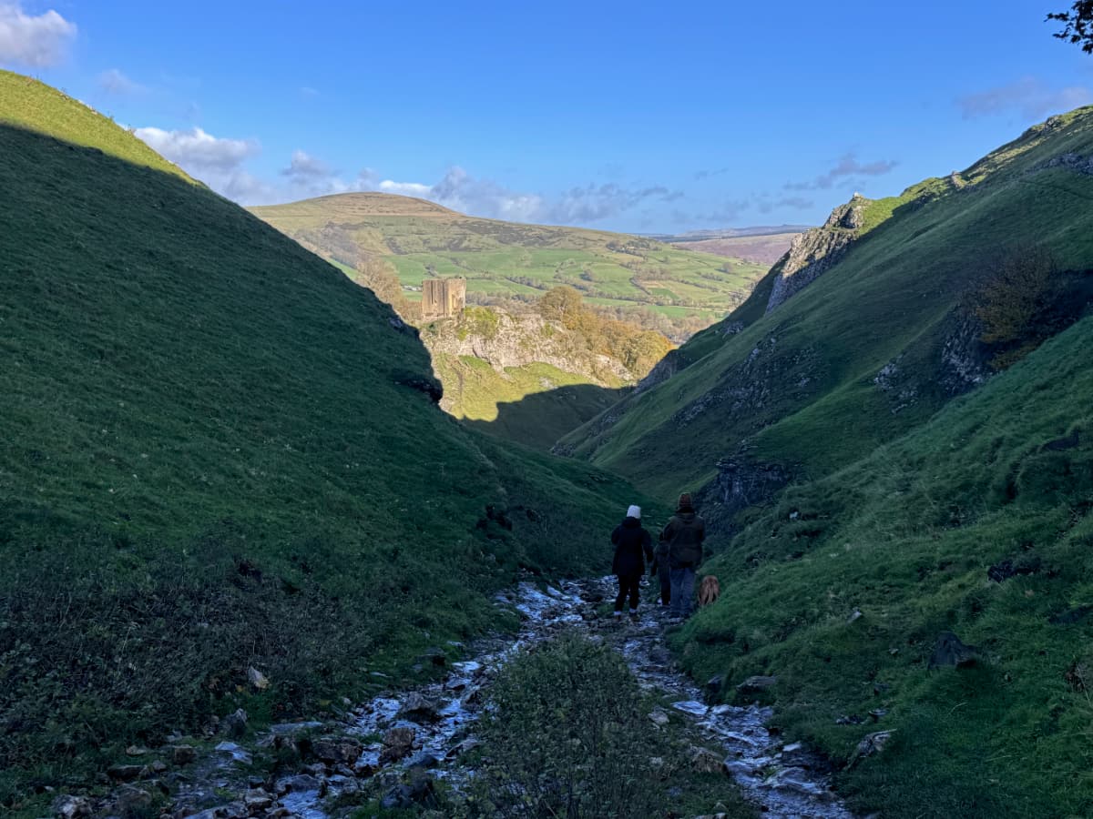
The vale led up into the hills, where what few trees survived did so by clinging precariously to the rocky slopes:
Close to the top there was a path leading away from the vale and into hilltop moors. Soon I was in an open featureless expanse, the trails only identifiable by upright posts. This reminded me a lot of the tundra-like environment at the top of Newfoundland's Gros Morne, which also needed signposts to keep you from getting lost.
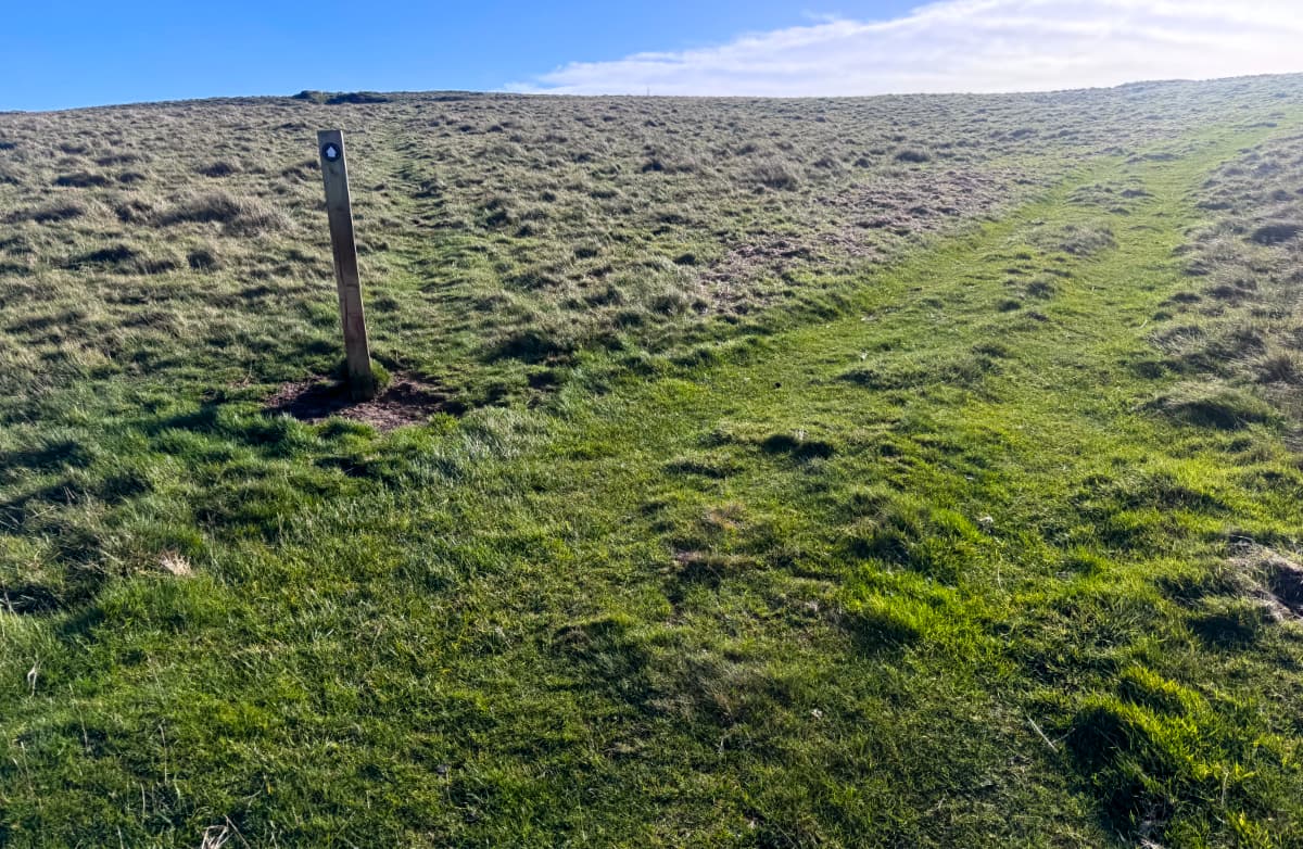
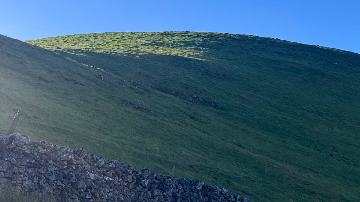
Now I needed to find my way back down again, ideally on a less rocky path. The fields and moors along the hilltops in the Peak District don't have paved trails. Sometimes the only indication of a trail is a rustic stone gateway with an enigmatic signpost nearby, out in the middle of nowhere and with no other context. You quickly figure it out, though.
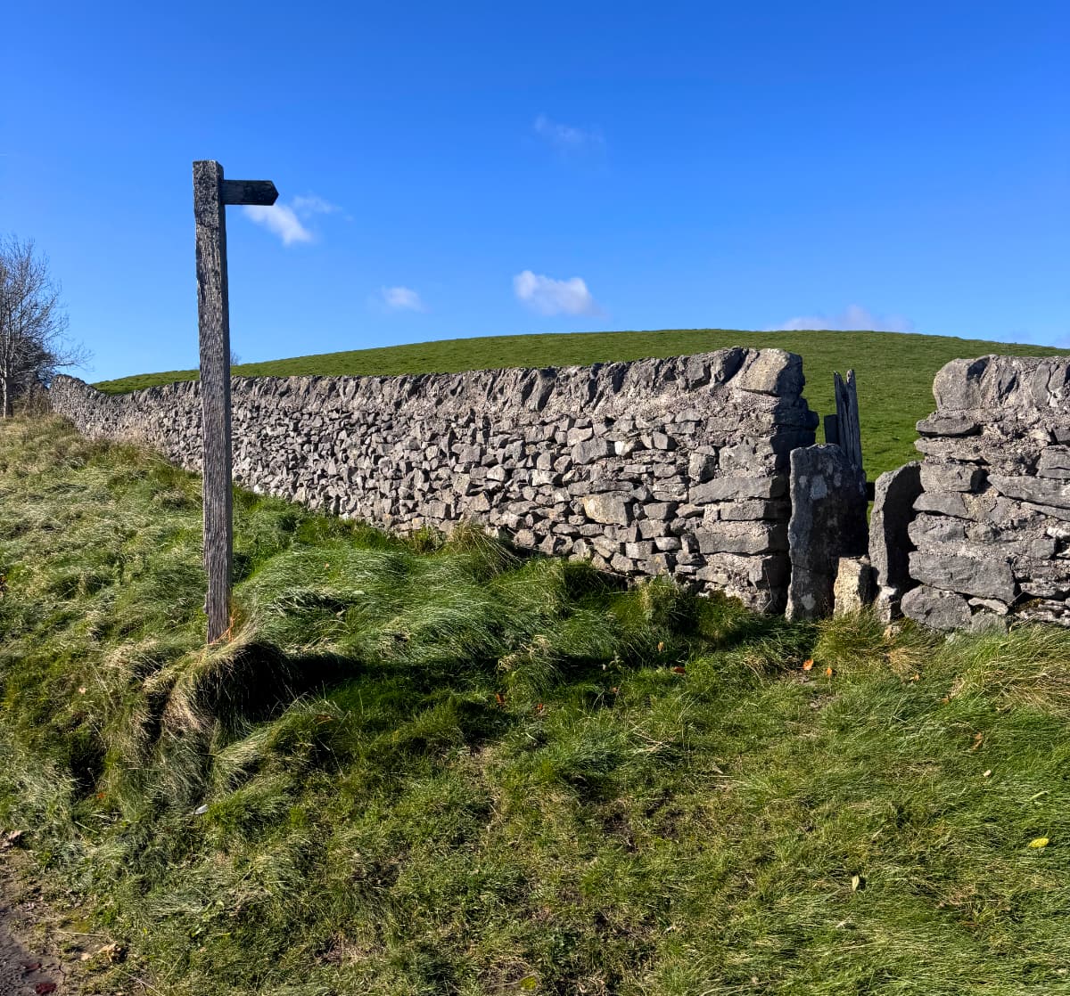
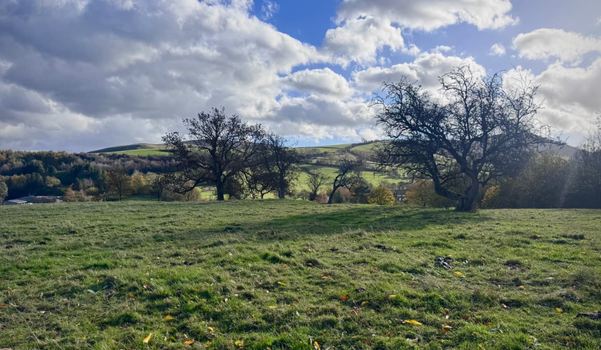
I imagine this whole experience would have been very different if it had been a foggy day instead of a sunny one. I continued across wide open fields, with stone walls and the occasional scenic tree:
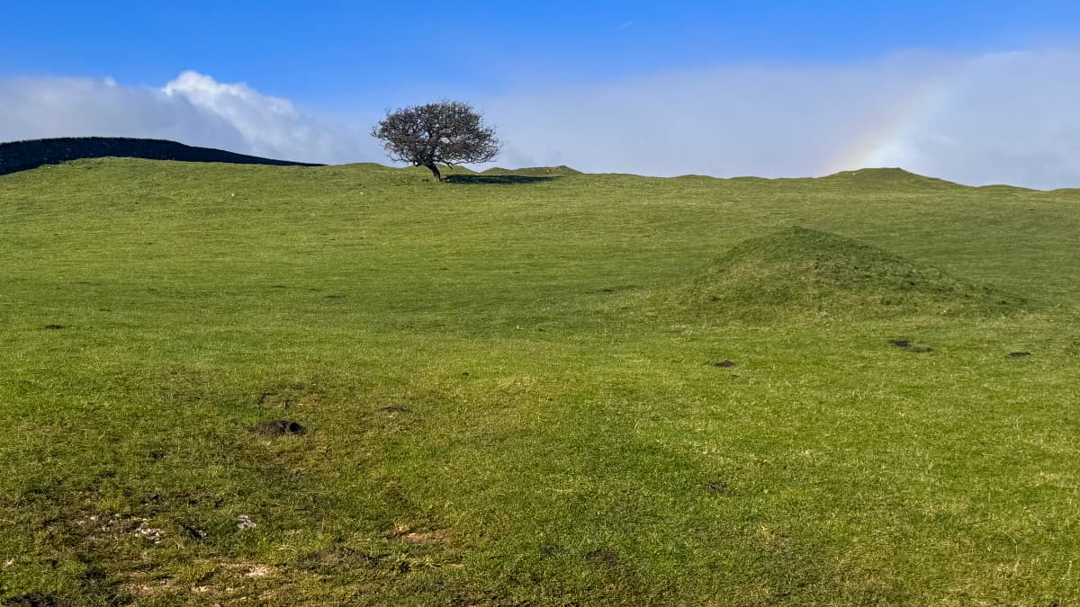
You can see a bit of a rainbow on the right side of that picture. My watch and phone were continuing to buzz at me every fifteen minutes or so, letting me know that there might be a brief burst of light rain shortly. I didn't get very damp, but it made for more great rainbows, like this one over an old orchard.
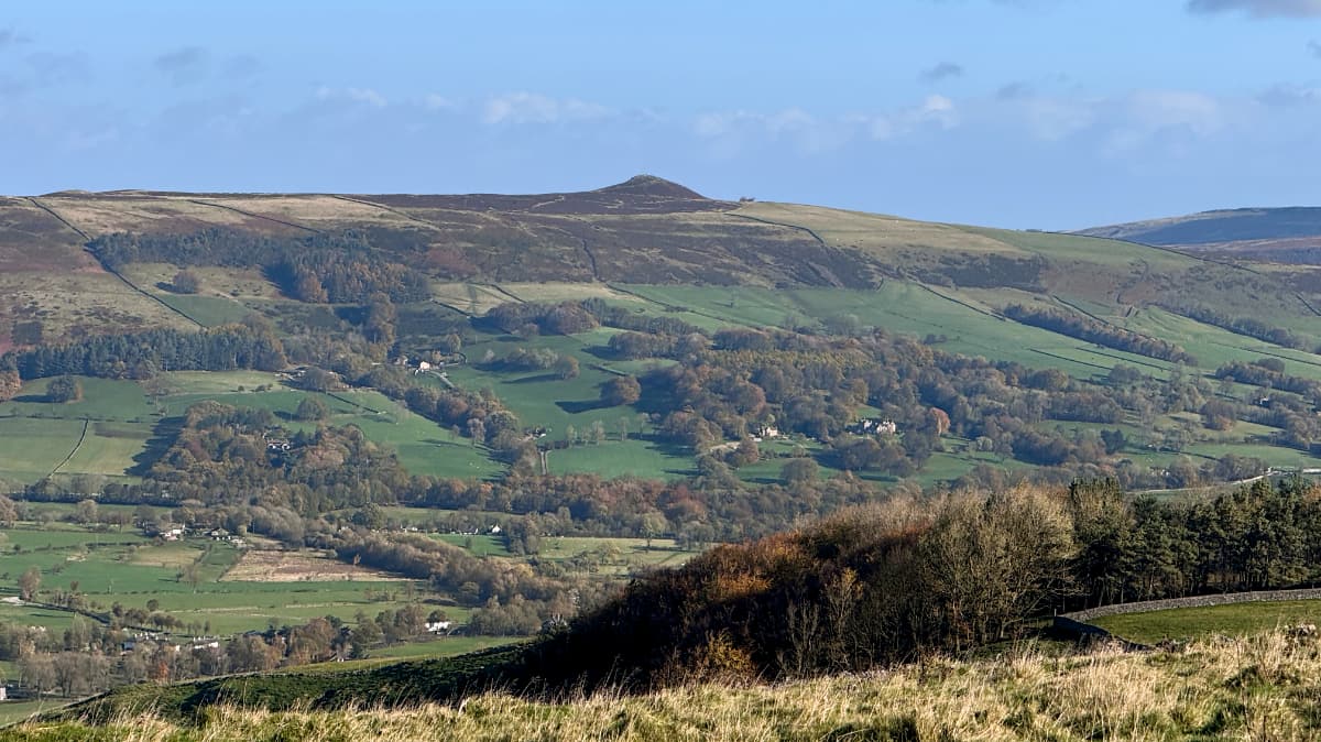
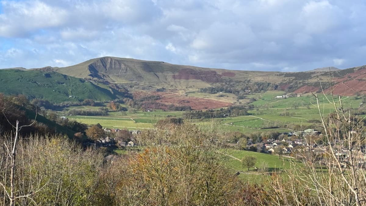
At various points I had a sweeping view across the valley, and I realized that the peak in the distance was the "pimple" on Win Hill that I had climbed yesterday.
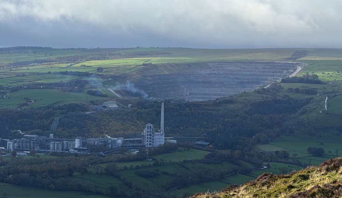
After some walking along the roadside, I found I was skirting the edge of the giant open-pit mine I had, appropriately enough, seen from the opposite slopes yesterday:
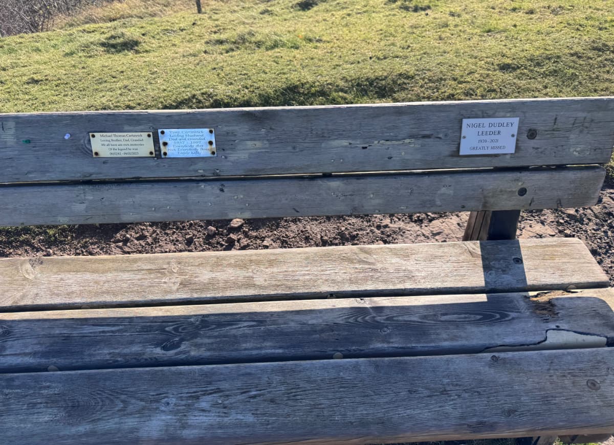
On this side there was a little field full of sinkholes and a view of the pit and the smokestack, but also a lone bench:
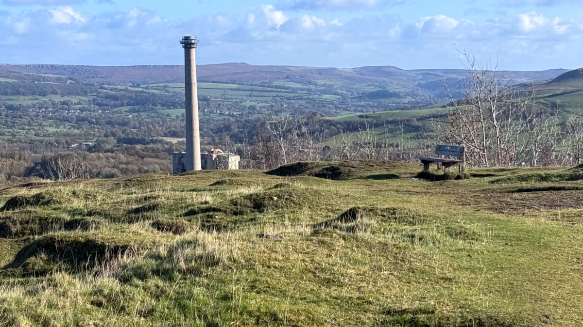
This bench turned out to have a spectacular view of the Hope valley – this picture does not even begin to do it justice.
As befitted such a prominent bench, there were multiple plaques: to Tony Cartawick (1997, loving Husband, Dad, and Grandad), Michael Thomas Cartawick (2023, legend), Nigel Dudley Leeder (2021, greatly missed):
A zig-zag road led me back down into the pastures and forests of the valley. Looking back up the hillsides I saw a Napa-Valley-in-Derbyshire version of the WindowsXP wallpaper.
Down in the valley I looked back towards the hills and the light and topography continued to be ridiculously photogenic:
I was nearly back to my hotel in Hope, but I still had energy for some more exploring. The maps and guidebook had noted that there was a Roman Fort nearby, so I thought I would check it out. The Romans had come here to mine lead, and some of the trails up in the hills are on the same routes as the old Roman roads.
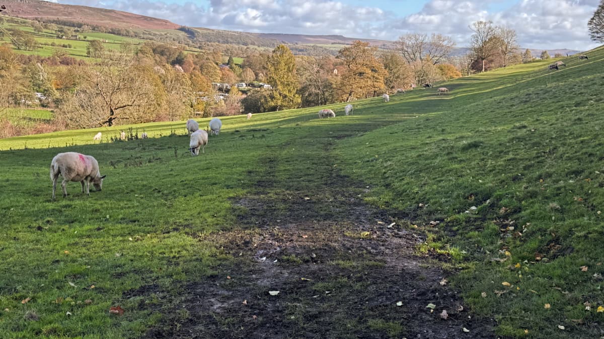
To get there I had to pass through a crowded sheep pasture. It turns out the sheep here are pretty chill about you walking through their grazing areas – as long as you don't have a dog with you.
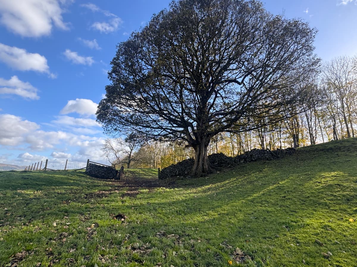
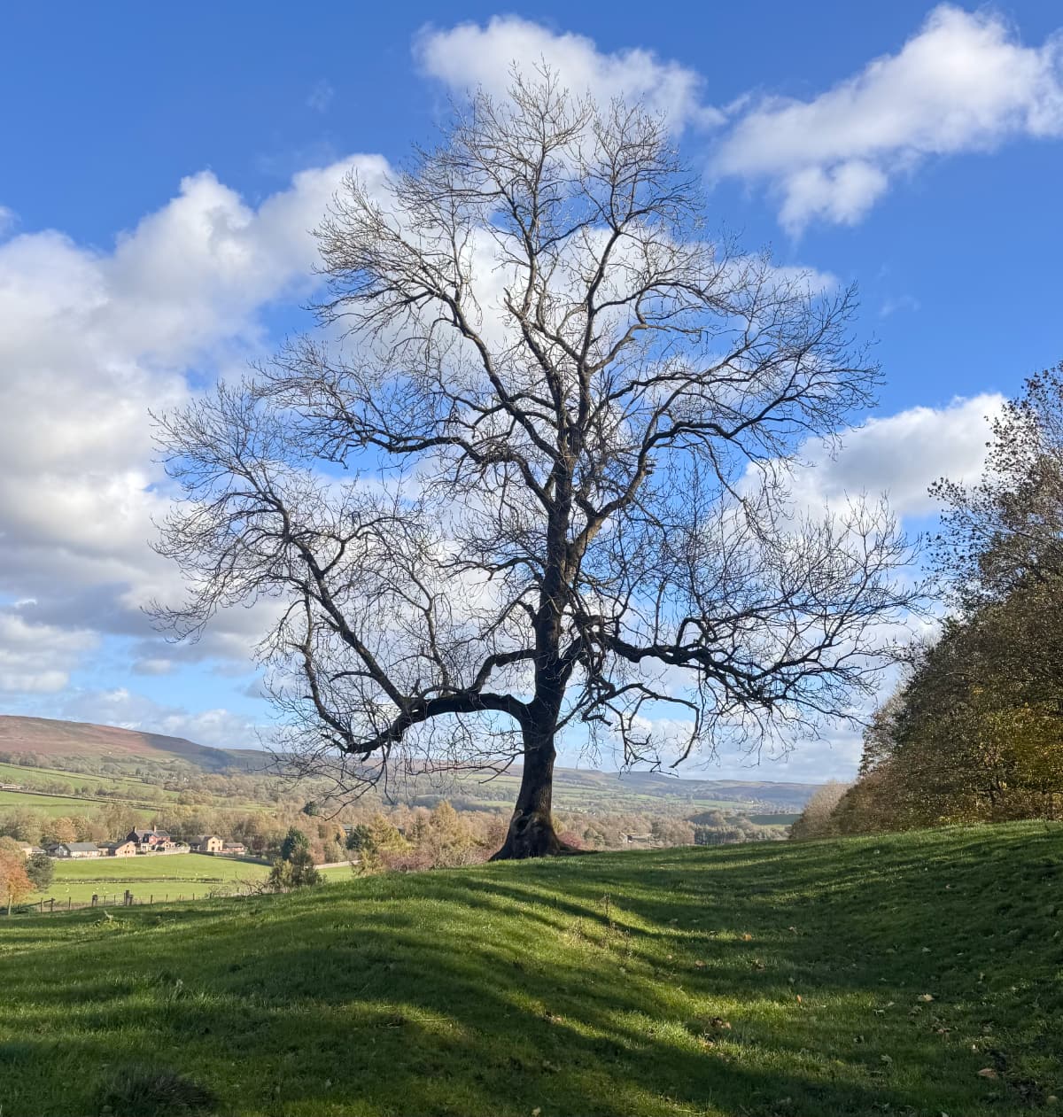
On the way I passed some spectacular trees. This late in autumn many of them have few leaves left, making the spread of their branches even more impressive.
After some meandering I came to the old Roman fort. I had hoped that there might be some mosaics or other relics, but all that was left was a raised and flattened rectangular earthworks surrounded by a now shallow ditch, as per Roman tradition. The location was as scenic as it had been strategic:
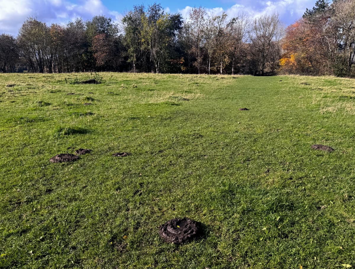
The dominant feature of this old Roman fort in the 21st century turned out to be cow patties, scattered about like land mines, and nearly as fraught to step in. As I carefully walked back, I pondered on "the glory that was Rome".
(The Roman connection is the origin of the cheeky name for my blogpost, mixing "Cave Vale" and the Latin saying from Catullus "Ave atque Vale")
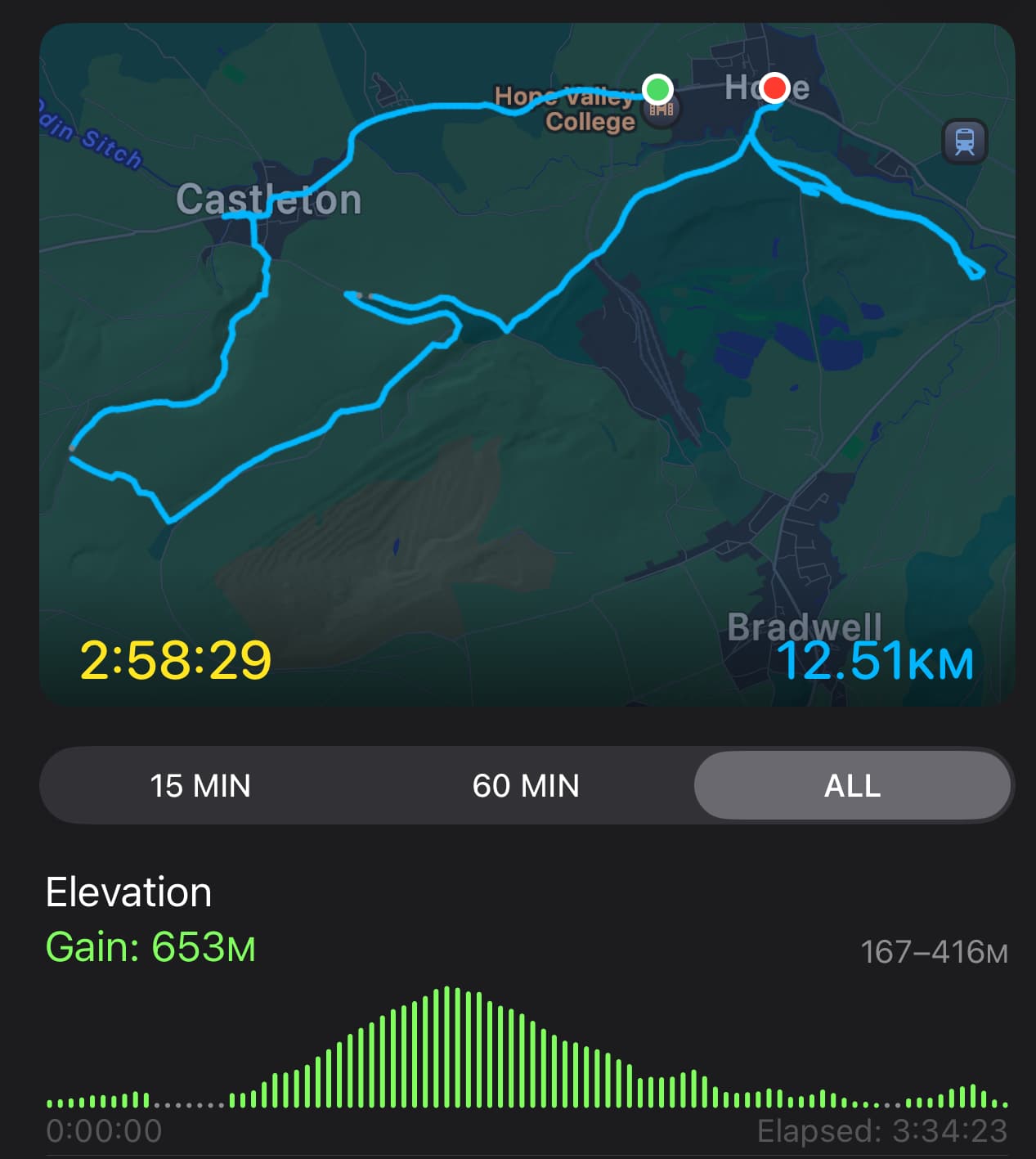
I made my way back to the village of Hope and to my hotel. Once again I was able to review an automatically generated map of my travels on my phone:
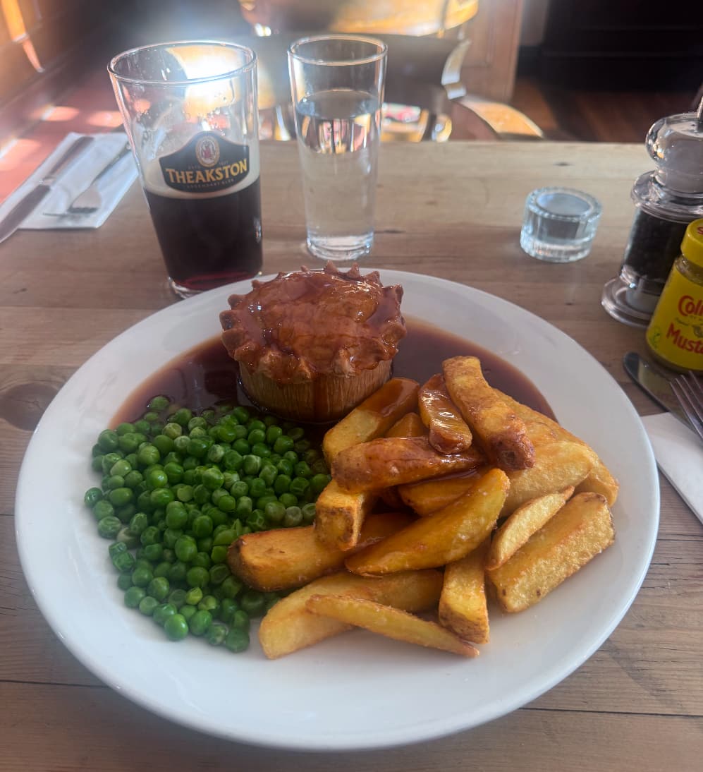
Yesterday I had seen this epic meat pie on the menu.
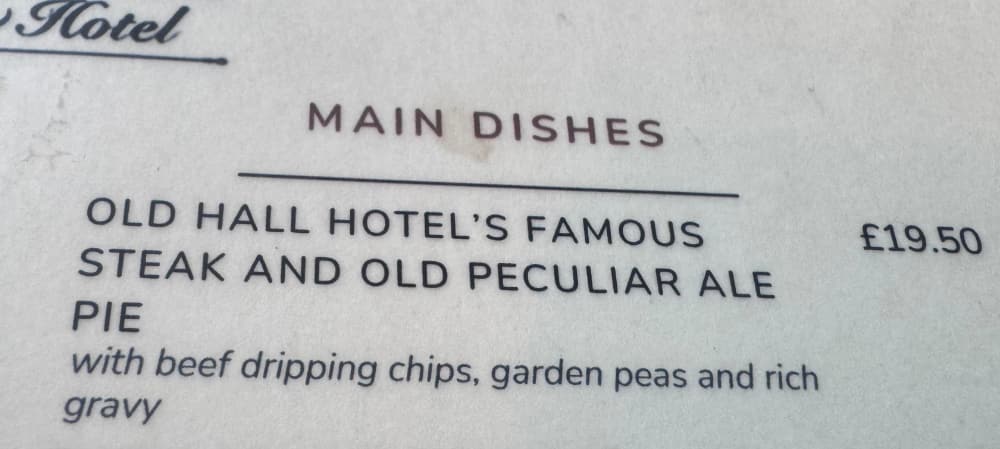
After today's adventure I had properly earned it.