"Wh-wh-wha? Just give me some time to digest this."
It was our first morning in Gros Morne. We had planned on climbing the mountain at some point on our trip, but figured that we would ease into it by having some shorter hikes first. Shannon had noticed that the morning was sunny and clear and had suggested to me that we should climb the mountain today. This being Newfoundland, there was no way of knowing how long we'd have the nice weather, and you really don't want to navigate the top of Gros Morne in the fog or rain.
There's a part of me that really likes to stick with a scheduled plan. I'm open to changes, but it often takes me some time to digest them and reorganize my assumptions. We've been together for well over a decade, so Shannon has figured this out about me and knows what to do about it:
"Well, I'll buy you breakfast and you can think it over."
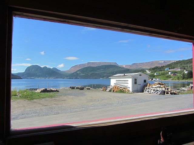
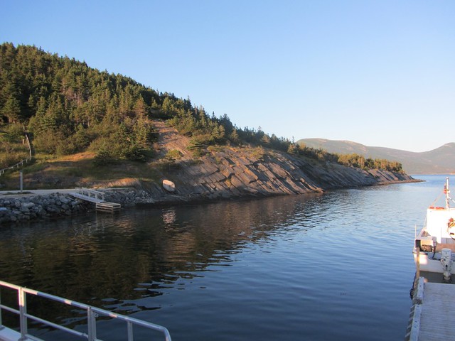
So instead of camp-stove coffee and instant oatmeal, we drove into Woody Point and had full bacon-and-eggs breakfast. It's not every breakfast place restaurant that has this kind of view from the counter:
(Note that you can click on any of these pictures to see a bigger version - and some of the ones here are best viewed as large as possible!)
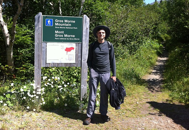
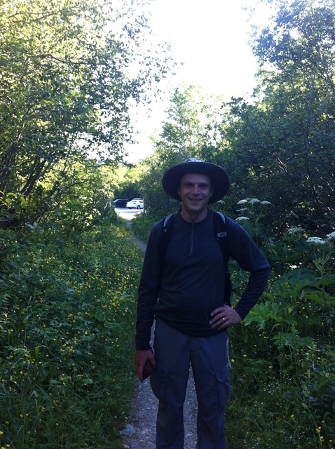
Fed and caffeinated, I started coming around. It was indeed a beautiful day, and why not start or visit with a bang? Shannon smiled and ordered us a pair of the "hikers lunch" packs they (conveniently!) sold at the restaurant and drove out to the trailhead.
Gros Morne mountain is what gives the entire region its name, looming 807 meters above the fjords and villages. The origin of the name is foggy - literally, perhaps, since it might be referring to how the mountain looms lonely and mournful in the coastal mists. It's more of a large hill rather than a pointy steep mountain, so climbing it wasn't going to require any special mountaineer gear or anything - but we had heard that it wasn't exactly going to be a leisurely stroll, either.
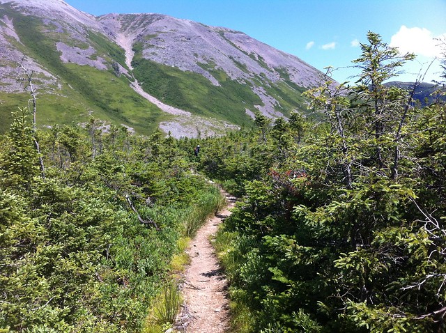
The first few kilometres of the trail are a gentle climb through forest and clearings, with the mountain looming larger and larger as you get closer its base. Because of the climate and the soil, a lot of the trees here are only a few meters tall, making us feel like giants.
As we took a water break an extremely athletic fellow jogged past us, presumably starting off on a running circuit of the mountain. I guess that's a way to get a good work-out.
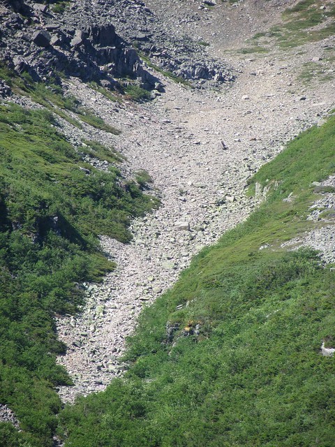
The 'normal' part of the trail ends at a platform with some plaques, some benches, and a view of Gros Morne's most prominent feature: a deep scar of tumbled scree dug out of one side:
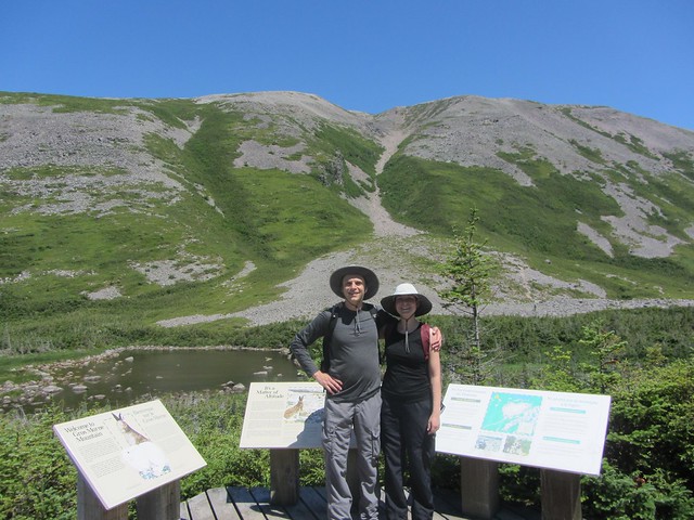
We met a lovely older couple who were visiting from Manchester UK. They had climbed the mountain together several decades earlier, but today were happy to sit on the bench in the sun and watch younger people scramble up the scree.
Wait, what? The scree?
We had sort of figured that there would be winding paths circling their way up to the top of the mountain. Nope - that's not the case. To get to the top of Gros Morne, you have to crawl on your hands and knees up several hundred meters of tumbled boulders.
Looking closer, we could see scattered tiny figures precariously scrambling up among the rocks in front of us. The Mancunian retirees smiled at us. "We managed it when we were about your age - you'll have fun!"
Well, okay! We had come this far, so we might as well do it.
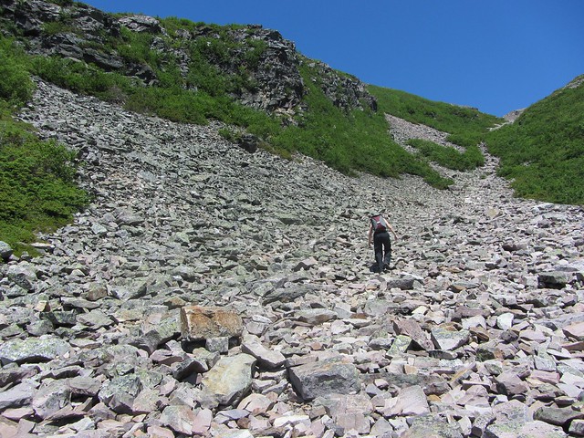
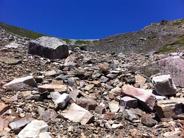
The scree may look like a big pile of freshly tumbled boulders, but most of the rocks are surprisingly stable - at least the big ones. Smaller rocks move a bit, but fears of slipping and then sliding all the way back down were unfounded.
We split up and each climbed the scree at our own pace, occasionally passing each other. I found it best to navigate between 'landmark' large rocks. Whenever I reached one I'd take a break, leaning on the uphill side of it, having some water, taking some pictures of the view below, and then finding the next large rock uphill to aim for.
Using my camera's zoom lens, I was able to see that the Mancunian retirees were still on their bench, presumably enjoying our slow zig-zag up the rocks.
I started reflecting that climbing a mountain is a bit like doing a startup or working on a big project: it's hard work, but you can really only focus on what's right in front of you. Keep some sense of the big picture, but just aim for the next goal and then the next one. Also, looking ahead, it always seems like you're almost at the top but that turns out to be just an illusion: get to the next ridge and you'll discover that you still have a lot more to go.
(Some day I should write a Business Insider-style blog post on "10 Ways That Founding a Startup Is Like Climbing A Mountain". This is not that day.)
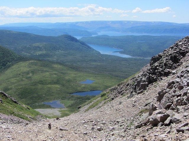
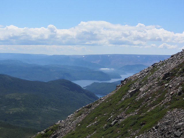
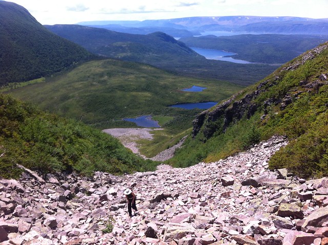
After an hour of climbing, we finally reached the top. In one direction was a spectacular view of Bonne Bay, with clouds below us.
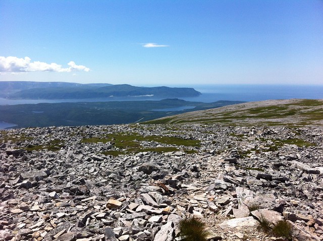
In the other direction was the flat top of the mountain, treeless, scattered about with rocks and tiny shrubs.
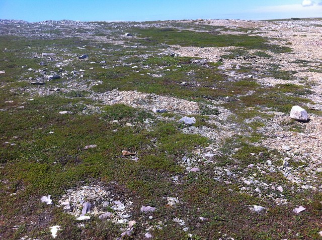
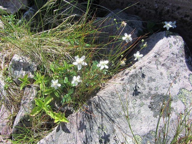
This terrain is officially classified as Tundra, and is home to arctic plants and animals, who presumably settled there during the last ice age. It reminded me a lot of the terrain I saw up in northern Alaska in 2010 - although mercifully there were a lot fewer mosquitos.
There was no longer any visible path on this rocky plateau, instead there were reflective markers every hundred meters or so.
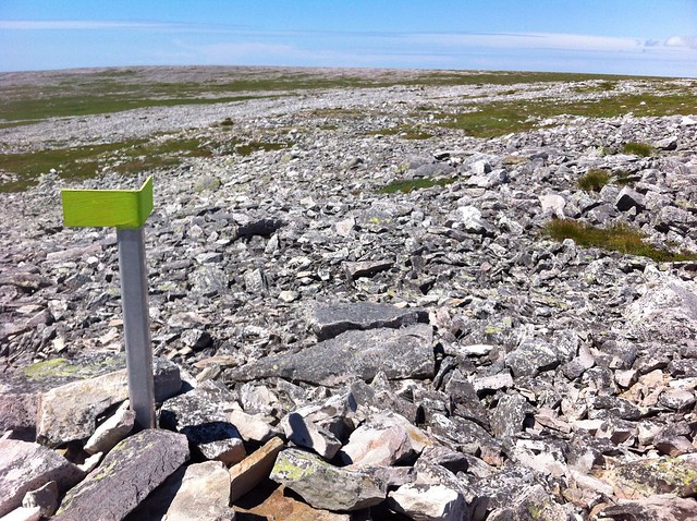
This is one of the reasons you don't want to get stuck on top of the mountain at night or in the fog: it's very easy to get lost and wander off a cliff or, perhaps worse, damage this fragile ecosystem under your hiking books.
Halfway across the top plateau is the official peak of the mountain. You can see several generations of signs at the same spot:

We had our lunches and chatted with a pair of women who were visiting from Gander. Shannon recorded a "hi I'm talking from the top of Gros Morne!" message for her grandmother.
Even up in this miniature arctic, there were pretty little flowers everywhere.
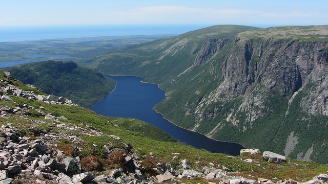
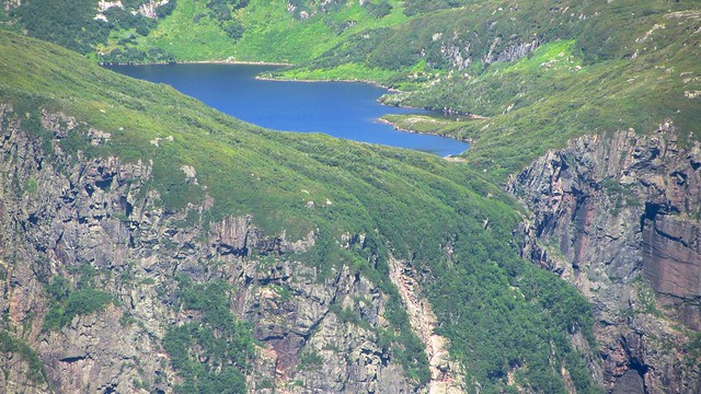
We reached the other side of the mountain-top plateau, and found a spectacular view of Ten Mile Pond and, beyond it, the ocean.
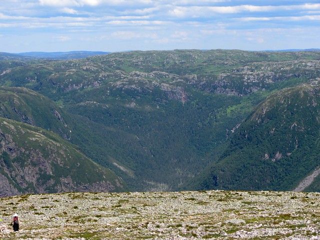
From up here we could see a lot of the surrounding countryside, including row after row of wooded hills stretching to the horizon, with no visible power lines, roads, or buildings. Basically, it's how the whole world must have been ten thousand years ago.
Our favourite feature was a pretty blue lake perched right at the edge of a cliff across from us. I thought about the waterfall it must make after a heavy rain. I also thought it would be such an awesome place to have a little cabin.
The way down was easier than the way up - they even provided steps. Lots of steps.

I tagged this picture for Keen, the makers of my great hiking boots, on Twitter and Instagram. They haven't noticed it (yet).
The rest of the hike back down the hill would have been spectacular on any other day, but after climbing the scree and crossing the tundra, it wasn't very exciting.
The summer heat was starting to get to us, though. There isn't a lot of shade when you're taller than most of the trees!

As we circled back around to the front of the mountain we saw the scree face again, and I could pick out the various landmark boulders I had aimed at in my climb several hours earlier.
The last stage of the hike was to retrace our steps back down through the pygmy forests to the parking lot - and it seemed to take just a fraction of the time it had coming up at the beginning of the day. We had left at 11:30am, and made it back to the car at 6pm - seven and a half hours of hiking!
We decided we wanted more than just camping food after this kind of a day, so we decided to drive into Norris Point and we found a little restaurant/pub with a nice patio on the water. We had chowder and beer.

It might have just been our celebratory mood after 'conquering' Gros Morne, but the beer from the Quidi Vidi brewery was extremely tasty. We also quickly realized that on a warm summer evening this might be one of the best-looking patios in the country:

It had been a day of spectacular scenery: from rocky tundra to massive cliffs, from vast horizons to sunset on shoreline over a fine pint of beer. We got in the car and drove back to the campsite. Gros Morne had one more surprise for us, though: the rising full moon reflected in Trout River Pond:
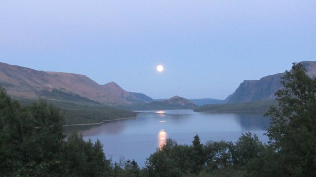
As we pulled the car over and I got out to get a good picture, I remember shouting, "This is too much! Too much!"
We had only been in Gros Morne for a bit more than one day, and already I was feeling overwhelmed by gorgeous spectacle.
We had four more days. This was going to be tough. I've never been daunted by scenery before.
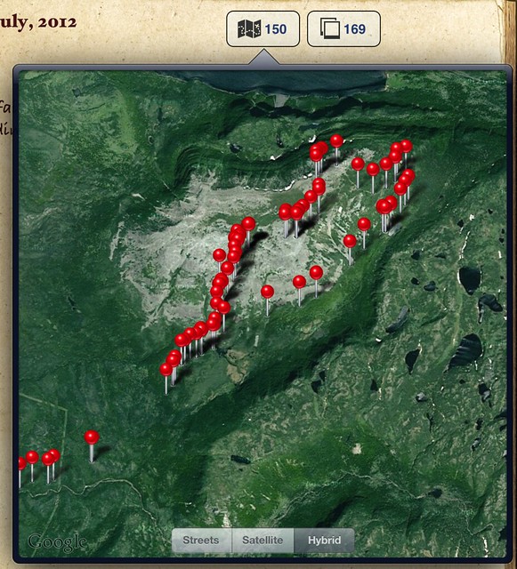
The sky finally grew dark and we dozed off in our mercifully non-spectacular tent. The campground had wi-fi and I was able to retrace our day's hike in Remembary's auto map feature:
I dozed off, feeling accomplished.
Gros Morne mountain is like Cinderella's Castle at Disneyland - it's the centrepiece of the park, visible from almost every part of it, sometimes towering above, sometimes peeking out in the distance. Most of the time, the scar of the scree face is prominently visible too. Every time we saw it during the rest of our visit, we looked at each other, smiled, and said, "Yeah, we climbed that!"
Here's a slideshow of all of the pictures from my Gros Morne trip: